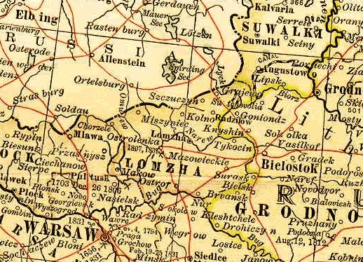
Map of the Polish Provinces of the Russian Empire, 1902
From Century Dictionary and Cyclopaedic Atlas, 1902 Courtesy of FEEFHS, Federation of East European Family History Societies
Radzilow was about 15 miles to the East of the Prussian/Russian border

 Return to