|
Designed and created by Jose Gutstein. Copyright © 2005-2022 by Jose
Gutstein. All rights reserved.
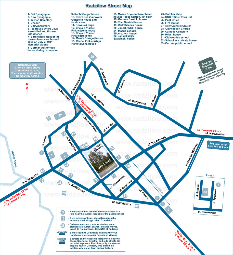
I am working on a very detailed and much larger map, complete with
side streets and more exact house documentation, down to the last
house, especially around Town Square and the main streets on the
west side which were heavily populated by Jewish families, using
photographs and video. Literally, a house-to-house documentation,
with markers for every individual structure. There are other Jewish
family houses throughout Radzilow which I'm already able to
pinpoint, but have decided, for various reasons, including lack of
cooperation by their landsmen families on other matters, not to
include them in this public map. |

 Return to